
search
London heathrow airport map
Map of heathrow airport. London heathrow airport map (England) to print. London heathrow airport map (England) to download. London-Heathrow is the busiest international airport in the world. Heathrow terminals serve more than 180 destinations in more than 90 countries. Whether London-Heathrow is your place of arrival, departure or transit, the London Heathrow Airport Map is designed to help you make your trip a simple and enjoyable experience.
Transfer from London Heathrow Airport by bus is possible. Refer to the map Heathrow Airport. National Express buses run between Heathrow Airport and London city center. The trip lasts between 40 minutes and 1:30 depending on the traffic and the route. The fare is £ 4 one way and £ 8 round trip to Heathrow Airport.
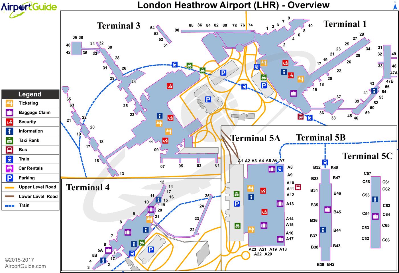
Map of Heathrow Airport Terminals: Heathrow Airport is divided into five terminals, each with shops, restaurants, exchange offices, information desks, accommodation booking offices and luggage storage services. The map of Heathrow Airport London will help you to locate between the terminals and for the car parks.
There are several routes serving the airport as shown on the map of Heathrow Airport. Heathrow Terminals 1, 2 and 3 in London are served by the following motorways: M4, Exit 4; the M25, exit 15; the A4 (national road). Terminal 4 is accessible from the following highways: M4, Exit 3; the M25, exit 14; the A30 (national road).