
search
London transport map
Transport London map. London transport map (England) to print. London transport map (England) to download. Public transport in London is quite expensive compared to prices posted in other European capitals. For example, a one-way ticket costs £ 4.90. The main means of transport are: metro, train, bus, taxi and bicycle. The London transport map shows the different lines of these public transports. The London public transport map is free.
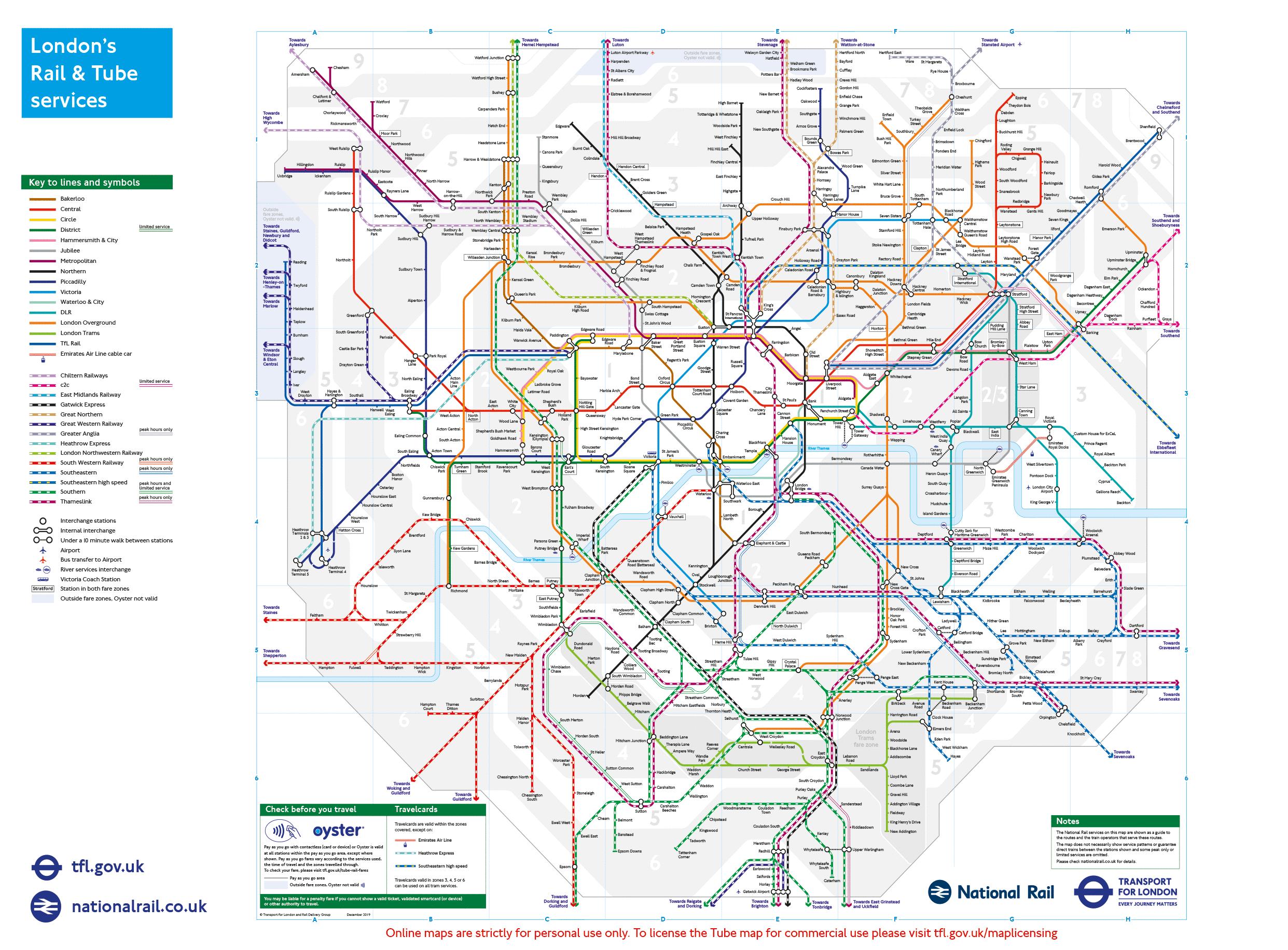
The transport map of London shows the 11 metro lines, the 2 lines of the DLR (Docklands Light Railway) and the London Overground. To find your bearings, each of the 300 stations has its name and color. The Oyster Card: the key to access all public transport in London. With the "Pay as you go" option, you will pay according to your journeys.
London has one of the largest urban transport networks in the world, with integrated bus, river and road systems spanning London 32 boroughs. Public transport in London is quite expensive compared to prices in other European capitals (see London transport map). For example, a one-way metro ticket costs £4.90. The main means of transportation in London are: metro, trains, buses and bicycle.
In London an organisation called TfL (Transport for London) coordinate all public transport. One of the aspects of this duty is releasing the official maps and it is these that should be consulted. When you are in London you will be able to pick-up hard copies of the maps at the various information centres. The most popular map by far is the London Underground transport map which you will find at most underground stations in dispensers in the public areas. These are free.