
search
London airports map
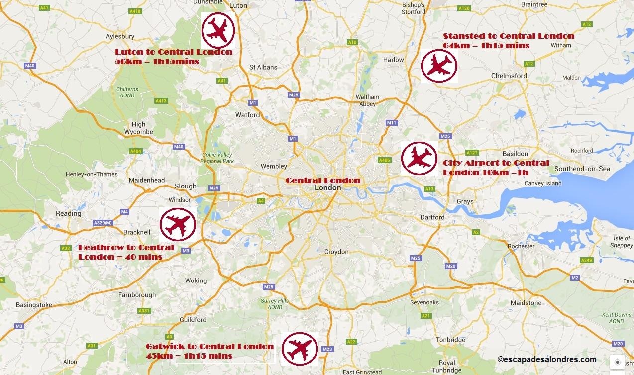
London airport map. London airports map (England) to print. London airports map (England) to download. The city of London is served by five major airports and a small sixth (Southend) as shown by the map of London airports. To reach the center of London, you need to determine your arrival airport. - London Heathrow Airport 32 km west of London; - London Gatwick Airport 45 km south of London; - London Luton Airport 56 km north west of London; - London Stansted Airport 64 km north east of London; - London Southend SIA Airport 65 km East of London; - London City airport 10 km east of London.
If you come by plane, we have listed how to reach London's city center from the city's airports: Heathrow, Gatwick, Standsted and Luton. The map of London airports shows you where each airport is located. Heathrow airport is the most convenient way to get to London as it is directly connected to London's underground network.
Five major airports serve London. The question arises then to find the fastest and / or the cheapest way to reach London and to be able to start your stay in London. Because if Heathrow, the largest of them, is located only 25 kilometers from the center of London (as shown by the map of London airports), an arrival in Stanted by a low-cost flight takes you away from more than 60 kilometers.
The map of London airports shows the 5 London airports:
- Heathrow: accessible by Piccadilly Underground or Heathrow Express or National Express Coach;
- Gatwick: accessible by Gatwick Express or Southern Trains and First Capital Connect;
- Stansted: accessible by Stansted Express or National Express East Anglia;
- Luton: Thameslink or First Capital Connect or East Midlands Trains;
- London City Airport: accessible by DLR or bus or train.