
search
London train map
Train map London. London train map (England) to print. London train map (England) to download. London Overground rail services crisscross the city and extend beyond the Tube network (as its shown in London train map). Most local train lines in London connect efficiently with the Tube and accept payment by Visitor Oyster card, Oyster card, Travelcard and contactless payment card. Journeys by train and other modes of public transport can be planned online using the Transport for London Journey Planner.
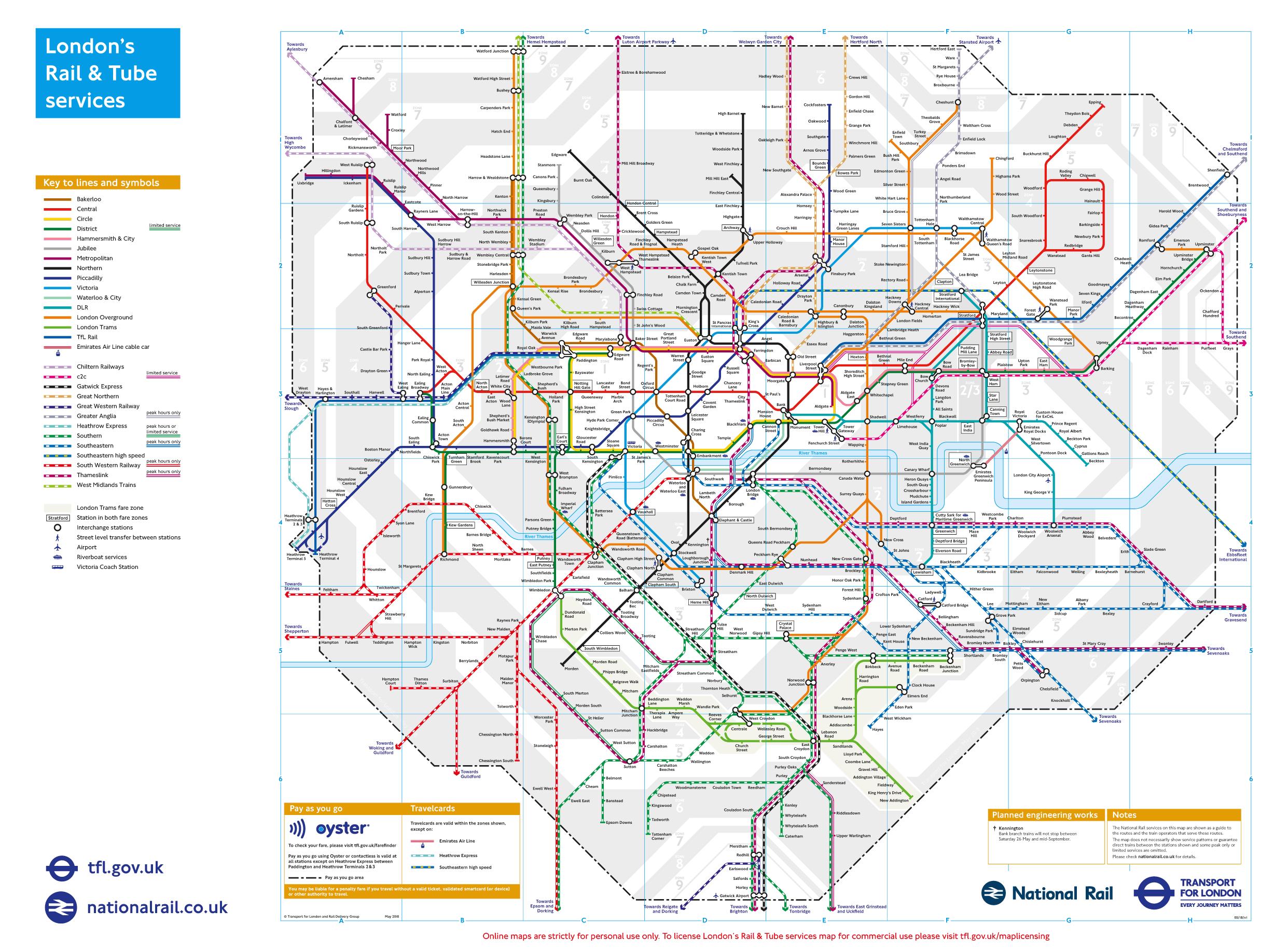
Around London, there is usually only one commuter train operator per line. But the choice is essential to the stations served by different lines. The London train map will help you to orient yourself. To find the right operator, the easiest way is to search the internet or come to the station and ask for options.
Two other subway-type transport systems are visible on the London train map. These trains make it possible to move in certain parts of London: the Overground and the Docklands Light Railway (DLR). The Overground is a train that essentially covers the outskirts of London. The DLR is an urban train network that covers only the eastern part of London.
In addition to the subway in London, there are suburban trains shown on the London train map. Several train lines belonging to several companies quickly serve London from end to end through the center. DLR, Crossrail, South West Train, C2C, First Great Western, Chiltern Railways, Abelio Greater Anglia, Southeastern Railway and finally Heathrow Connect: these 12 trains form one of London rail transport systems.
London has a large number of commuter trains serving cities around the capital. Mainly present in the south of London, the trains are operated by various companies according to their directions. Trains on the National train Map of London depart from London major train stations with service every 15 minutes on average.