
search
Hyde park map
Map of hyde park London. Hyde park map (England) to print. Hyde park map (England) to download. Open to the public in 1637 and covering an area of 142 hectares of greenery, Hyde Park in London is the largest park in central London and one of the nine royal parks of the capital. The Hyde Park London map is available on this page. To the west, as the map of Hyde Park shows, is Kensington Garden, which is separated from Hyde Park by Serpentine Lake.
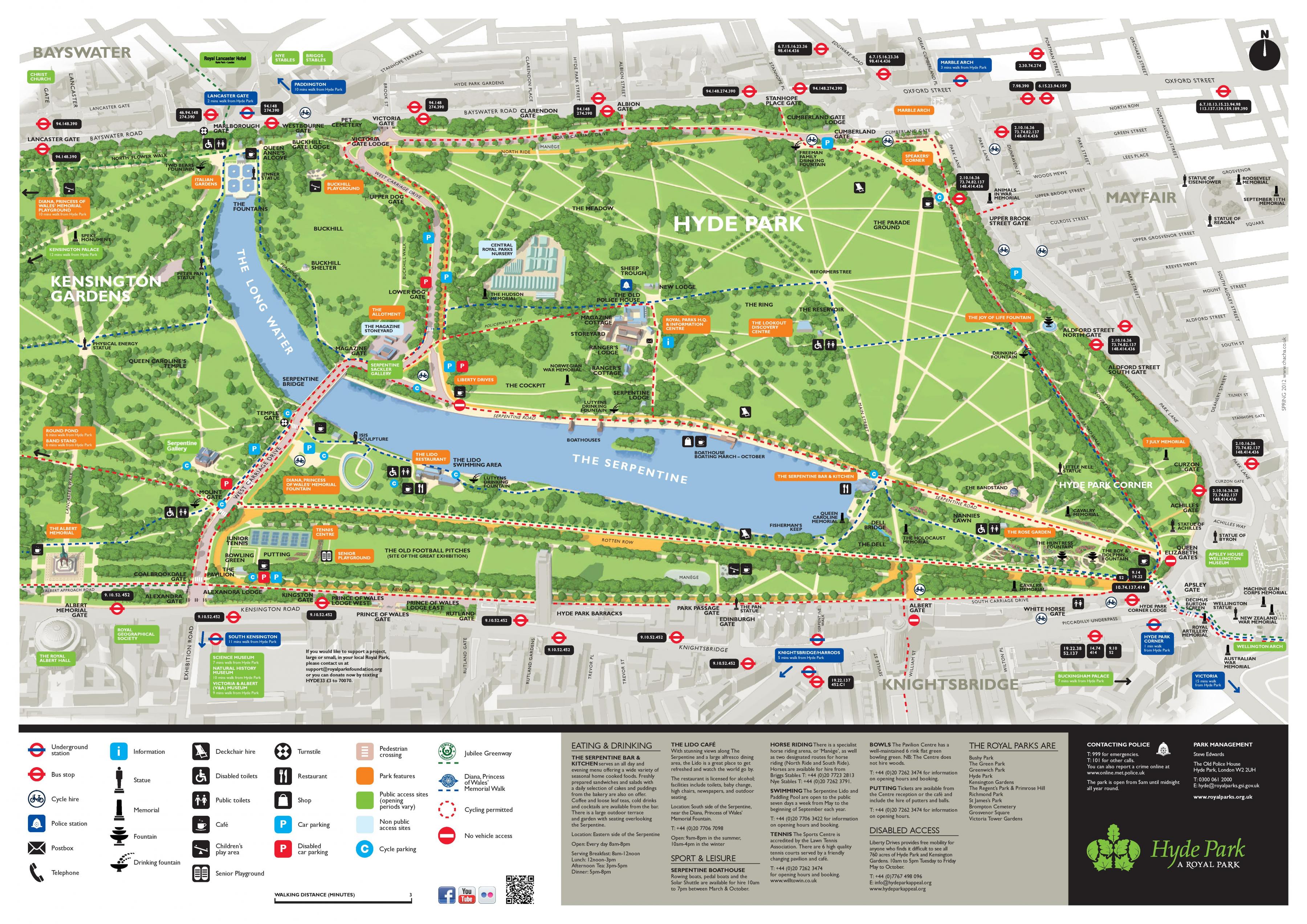
The main entrance of Hyde Park in London is formed by 3 doors interconnected by columns, as shown in the map of Hyde Park. On the central portal of Hyde Park, one can admire a fresco depicting the military navy in procession. On the Hyde Park map, there will also be a triumphal arch that celebrates Waterloo's victory.
Hyde Park in London hosted the Great Exhibition of 1851, where the Crystal Palace was built for the occasion. Hyde Park is considered to be one of the oldest parks in the city, the map of Hyde Park allows you to discover it. Since its inception, Hyde Park has been the scene of numerous duels, events and concerts.
At the time, Hyde Park (London) belongs to monks of Westminster Abbey and is rich in game. King Henry VIII of England, keen on hunting, decided in 1536 to recover it for his personal needs. A little later, Charles I made a circular path (as on the map of Hyde Park) allowing the horses to evolve easily and in 1637, the park opens its doors to the public....