
search
London borough map
Map of London boroughs. London borough map (England) to print. London borough map (England) to download. Greater London is divided into 32 districts, 12 in London and 20 in the suburbs as shown on the map of the London boroughs. Each district of London represents a local authority, with its own administrative services, schools, municipal services. The London Borough map is free. The London Borough map is downloadable and printable.
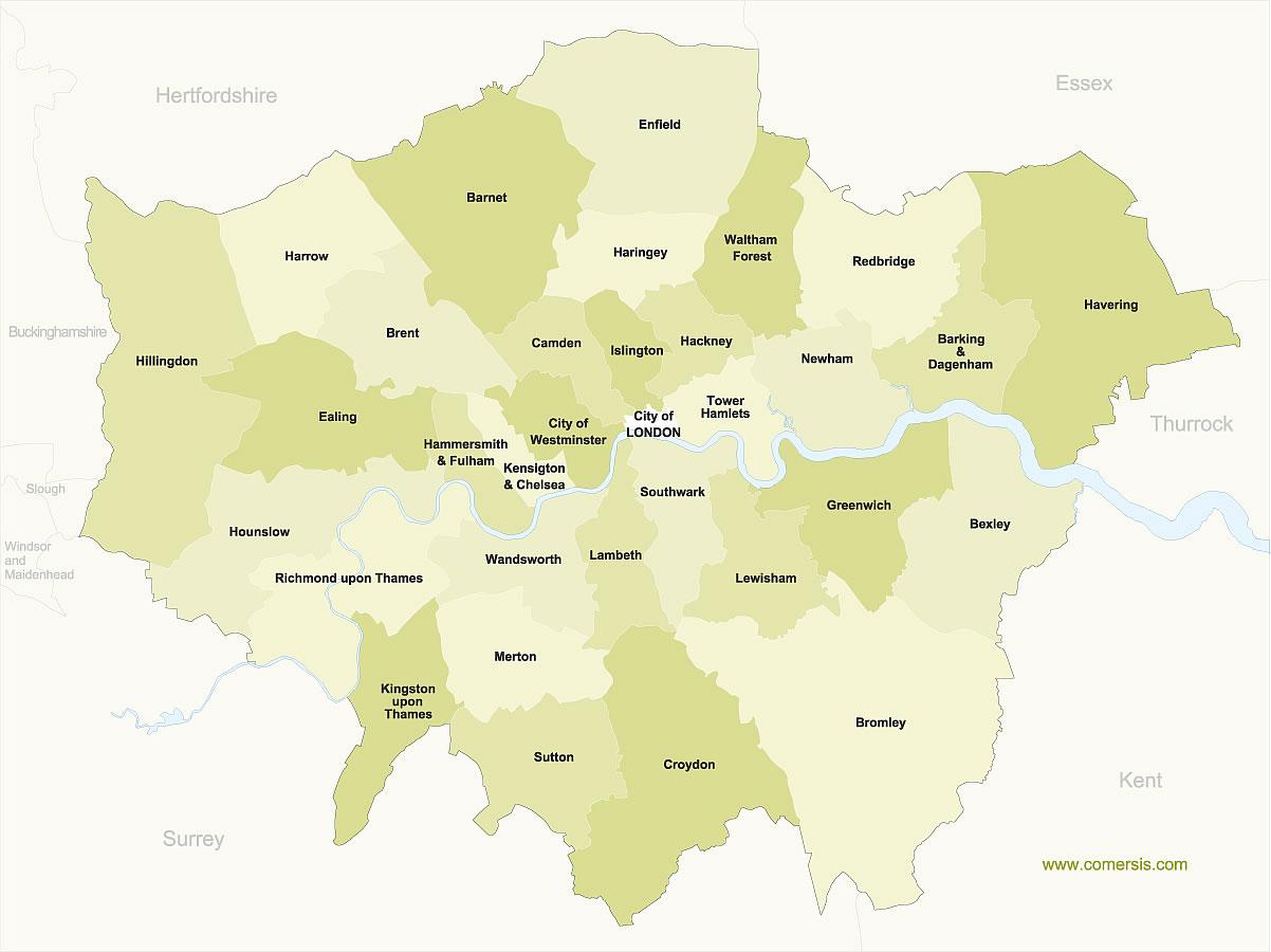
The London boroughs are grouped into five large areas corresponding to the four cardinal points plus the central area. These areas are subdivided as shown by the map of the London boroughs: the central zone, North, South, West and East, all organized according to the Thames which separates them and constitutes the border.
The arrondissements on the map of the London boroughs were formed in 1965. Since then, many minor boundary modifications have been made, the most important being the transfer of Farleigh to Surrey in 1969 and the later loss by Barnet of the hamlet of Kitt's End in the borough of Hertfordshire. Hertsmere.
A London Borough is essentially a form of local government, raising local taxes and administering local services. For example, London's postal codes divide London on a geographical basis for postal sorting, while the London boroughs divide London by boundaries between local authorities (boroughs). The map of the boroughs of London is visible on this page.