search
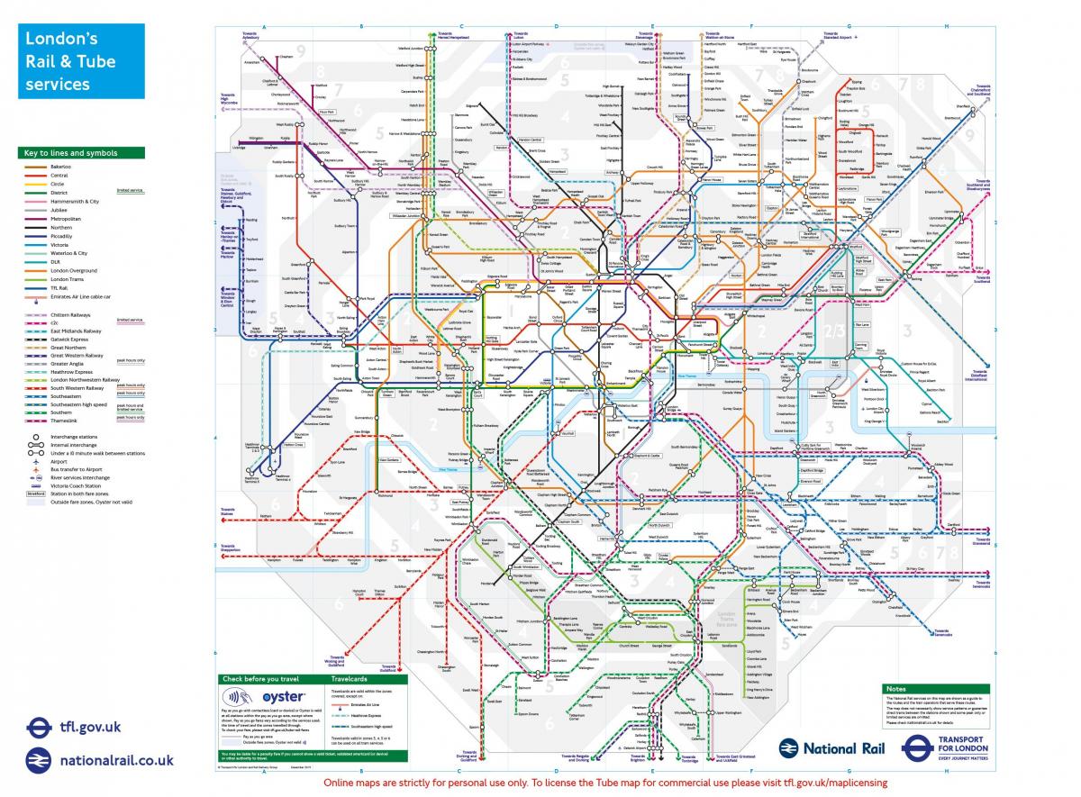
London connections map
Map of London connections. London connections map (England) to print. London connections map (England) to download. For the London visitor, the subway or train will probably be the best way to get around, as the London Connections map shows. East of London, the area is covered by DLR (Docklands Light Railway). In the suburbs you will find a train network called Overground. To the north and east of London, most of these services are now managed by TfL Rail or Overground.
The London Connections map of Transport for London (TfL), with its straight lines, 45-degree rounded corners and simple and clear cartography, is a design classic. The London Rail & Tube service map (see London Connections Maps) shows all the London railways. This London train and subway map is convenient for getting around Greater London.
London's rail services cross the city and extend beyond the metro system. This is visible on the London Connections map. Most local train lines connect efficiently with the Tube and accept Visitor Oyster Card, Oyster Card, Travelcard and contactless payment card payments. London Transport (TfL) London Overground currently operates rail services on six routes in London.
The majority of the lines are articulated around London and its seven main terminal stations, train journeys can include several connections. This is visible on the London Connections map. Finally, the international Eurostar line from King's Cross / St Pancras train stations in London, and Ebbsfleet or Ashford stations in Kent, allows you to reach continental Europe.


