search
London neighborhood map
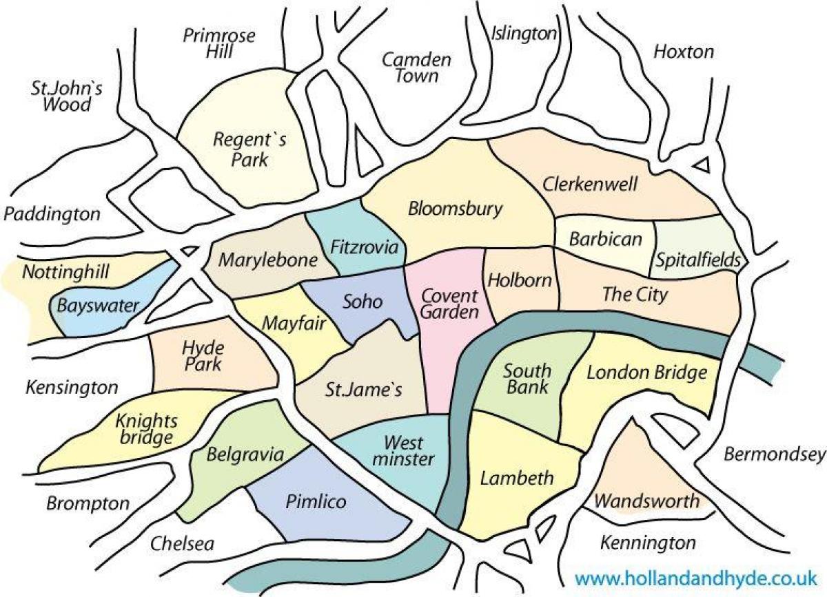
Neighborhood map of London. London neighborhood map (England) to print. London neighborhood map (England) to download. With 8.5 million inhabitants, London and its suburbs are full of neighborhoods to stay. But difficult to choose among the different areas of the city. The map of London neighborhoods will help you make your choice. Between the posh Chelsea and Kensington neighborhoods, the peaceful Westminster or the trendy ultras Shoreditch and Brick Lane, here's a map of London's neighborhoods to find you.
You want to find accommodation, but you do not know which neighborhood to look for in London? Or would you like to discover new places in London? This map of London neighborhoods is for you. An accurate map of London neighborhoods downloadable and printable. The map of London's neighborhoods is divided into 5 parts: the historic center, west / southwest, south / southeast, east / northeast, north / northwest.
The map of London's neighborhoods will not fail to amaze you, as London's neighborhoods are different and cosmopolitan. The area of London is 1500 km2. Because of this extent the centers of interest of London are very far from each other. In addition, like other capitals, London has very distinct neighborhoods that historically correspond to ancient villages.
London is divided into six main neighborhoods, the map of London neighborhoods presents them:
- Westminster;
- Chelsea, Kensington and Notting Hill, to the west;
- West End, north;
- Camden, north of West End;
- Shoreditch, to the northeast;
- Southwark, on the south bank of the Thames.
Each of London's neighborhoods have their own monuments and ambiance.


