
search
London train station map
Map of London train stations. London train station map (England) to print. London train station map (England) to download. Most tourists will be confined to zones 1 and 2 of the London Underground map. Indeed, these areas of the London Underground cover the tourist part of London. The London Underground has 11 lines, each associated with a color (as shown on the London Tube map) to facilitate travel and connecting travelers: Bakerloo (brown); Central (red); Circle (yellow); District (green); Hammersmith & City (pink); Jubilee (gray); Metropolitan (purple); Northern (black); Piccadilly (dark blue); Victoria (light blue); Waterloo & City (turquoise).
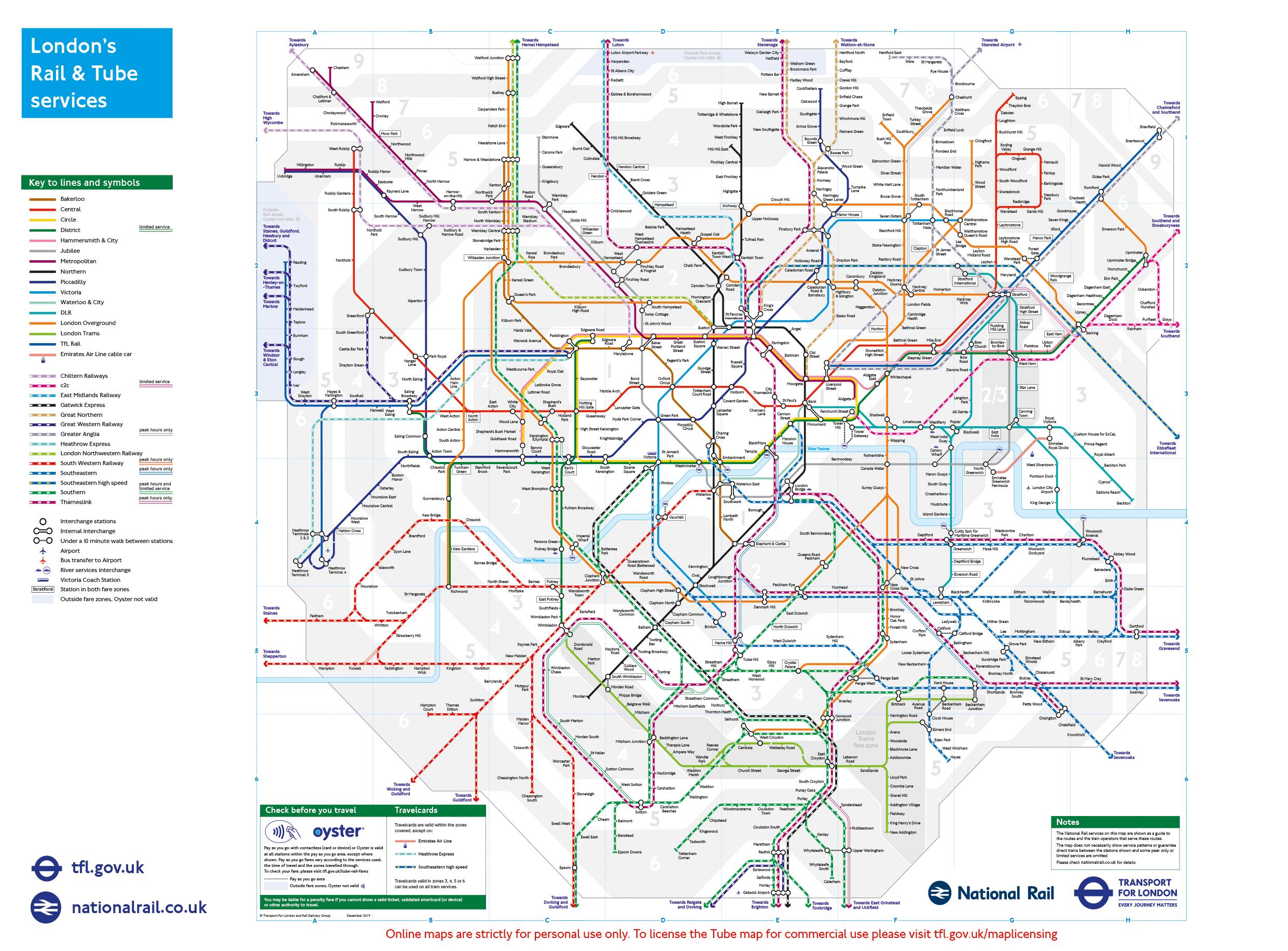
The other lines of the London Tube are less frequent. The DLR runs every 10 minutes. As for the Overground, depending on the day and the line, there are between 2 and 4 metros every hour:
- North London Line: 4 metros per hour from Monday to Saturday. From 20h are only 3 per hour and Sunday 2 per hour.
- West London Line: 2 trains per hour.
- Gospel Oak to Barking Line: 2 trains per hour and 3 during rush hours.
- Watford DC Line: 3 trains per hour from Monday to Saturday. Sunday, 2 trains per hour.
The Docklands Light Railway (DLR) and Overground are suburban trains as shown on the London Underground map. They run from Bank or Tower Gateway (near Tower Hill Station). The Overground, in orange on the plans, open and almost suspended line, serves the East London, the extreme north and runs east.
This map of the London Underground gives you the opportunity to see which area is your starting point and destinations and thus to know in advance the price you will pay. This map of the London Underground also shows you the lines of Overground and the London Tram. The overground is a network of trains serving mainly zone 2.