
search
London tram map
London trams map. London tram map (England) to print. London tram map (England) to download. An extensive tram network covered large parts of London for several decades during the first half of the twentieth century (see London tram map). By the 1950s, however, London trams were seen as old fashioned and were gradually phased out to create more room for buses and cars. The last tram journey in London for three decades took place between Woolwich and New Cross on 6 July 1952.
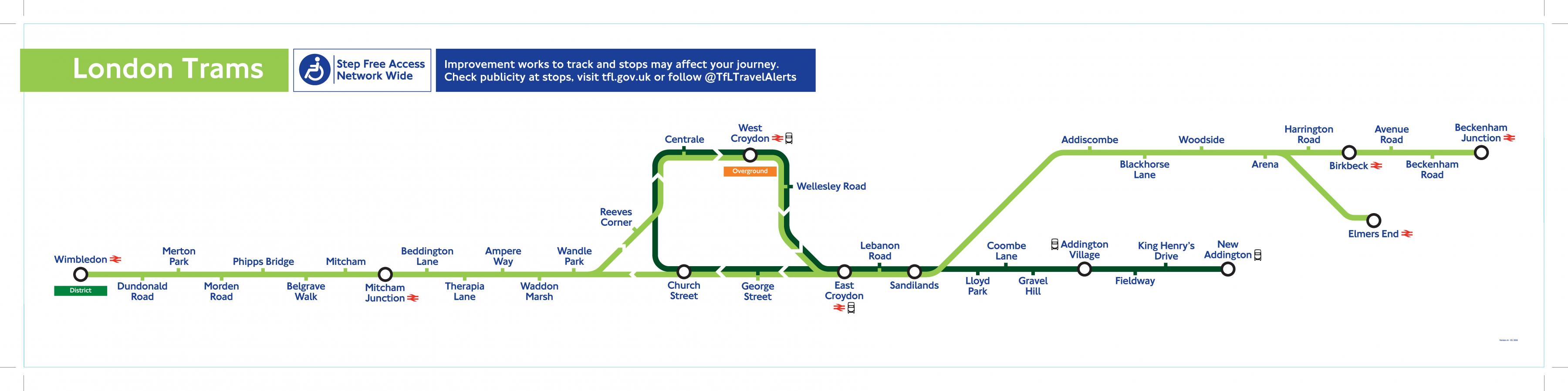
Trams run in parts of south London between Wimbledon, Croydon, Beckenham and New Addington (as its shown in London tram map). The services are frequent and accessible. London tram network, Tramlink, was introduced to south London in 2000. The London tram network runs from Wimbledon through Croydon to Beckenham, where it has proven a popular mode of transport.
The first generation of trams in London started in 1860 when a horse tramway began operating along Victoria Street in Westminster[ see London tram map]. This first line of London tram was operated by a somewhat eccentric American, George Francis Train. Initially there was strong opposition, as, although it was popular with its passengers, the first designs had rails that stood proud of the road surface and created an obstruction for other traffic.